Once the top lock-gates were shut then only a small amount of water would get through. The bottom lock-gates would open and the barge would start down the canal. Then other barges would follow it - but each time stopping the flow of water while refilling the lock! The River Gwash was an ideal opportunity that couldn’t be missed as this plan showed!
Looking at the date, it took a surprisingly long time to do necessary maintenance on the upper reaches of the River Welland. 200 years after the canal started it was agreed to straighten the main channel in two places!
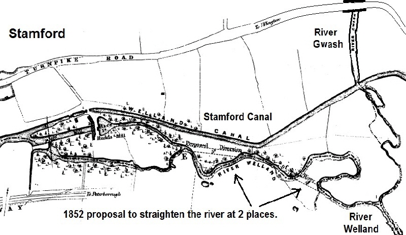
By putting in a weir on the River Gwash and controlling the flow with a sluice gate, the water level in the canal was maintained without any water from the River Welland.
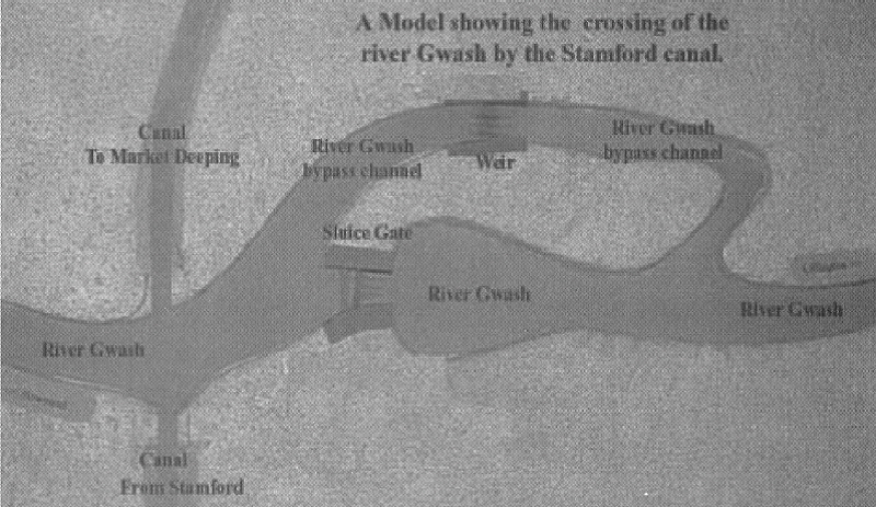
This plan from a model of the junction between the River Gwash and the canal shows how the water level was managed by the sluice gate. The sluice gate 2 metres wide and the weir being about 4 metres wide. Unfortunately this lady is a bit late to go paddling across the top of the weir!
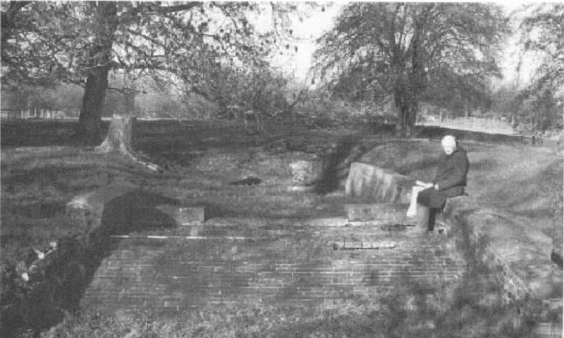
This is where the Stamford Canal became a real canal and not just a ‘navigation’; as most other river weir diversion solutions had been.
Note: in West Deeping it was called the Boaty or Boaty River, because of its flow - there was a lot more water in the River Gwash back then! It now feeds the Rutland Water reservoir and its output is carefully managed with just sufficient water to keep the flow through the villages in Rutland then the present River Gwash goes out via the Newstead mill stream.
It is believed the Newstead mill was set up by the Augustine Canons. The priory was originally founded during the late 12th century by William d'Albini III as a hospital and converted to a priory circa 1247, when the first prior is documented. It was dissolved in 1536. No physical remains are visible. Its location was thought to be ‘somewhere’ to the south of the mill but no records existed. Even when the main road at Newstead corner was re-aligned no signs of any buildings were found.
After a local talk at the Uffington village hall in late 2019, Ken Otter met Nick Sheehan who had written a book about Newstead Priory which contained images of earthworks found near the weir above.
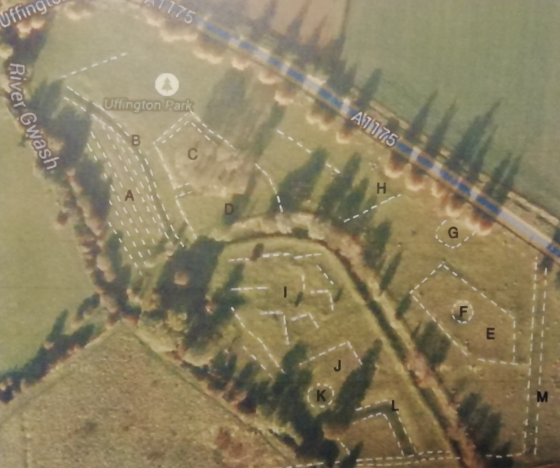
Soon after that meeting Ken found an aerial image with crop marks that confirmed the work Nick had found and clearly extended the building lines to show the extent of the priory - with the canal going straight through it!
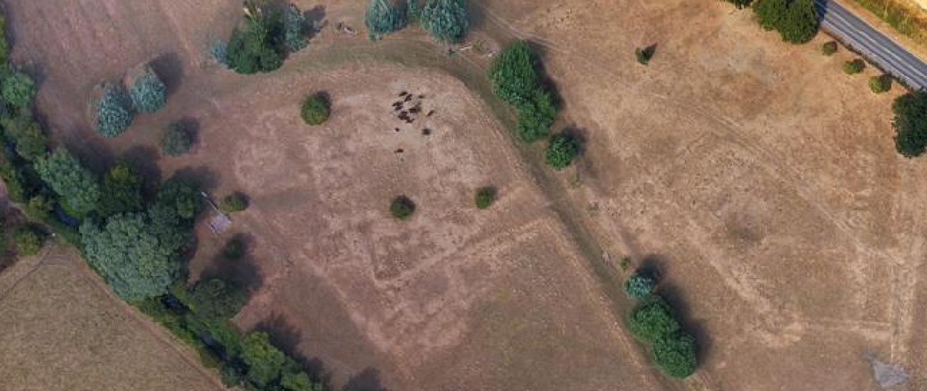
You never know what is going to turn up next!
Which is exactly why THIS is a website not a printed book!
It is hoped to be able to excavate an area to the south west area of this area in 2020 as the local Environment Agency wants to determine what is in a large pile near here. Watch this space!
< Back The source of water for the Stamford Canal
The Stamford Canal << The earliest proper canal in England? <<
